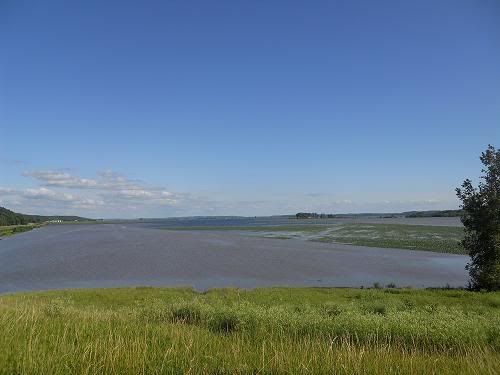
I'm reactivating this thread as heavy flooding exists in Nebraska and the Missouri River is rising rapidly to flood stage as far south as St. Joseph and Leavenworth, which was caused by that Bomb Cyclone weather pattern that crossed the Great Plains yesterday.
Flood Statement
National Weather Service Kansas City/Pleasant Hill MO
1014 PM CDT Thu Mar 14 2019
...The Flood Warning continues for the following rivers in Kansas...
Missouri...
Missouri River at Atchison affecting Atchison...Buchanan and Platte
Counties.
Missouri River at Leavenworth affecting Leavenworth and Platte
Counties.
Missouri River at Parkville affecting Leavenworth...Wyandotte and
Platte Counties.
...The Flood Warning continues for the following rivers in Kansas...
Missouri...
Missouri River at St Joseph affecting Doniphan...Andrew and
Buchanan Counties.
This river forecast incorporates planned increased releases from Gavins
Point Dam. In addition, recent precipitation and estimated snowmelt runoff
are also included.
PRECAUTIONARY/PREPAREDNESS ACTIONS...
Do not drive through flowing water. Nearly half of all flood
fatalities are vehicle related. As little as 6 inches of water may
cause you to lose control of your vehicle. Two feet of water will
carry most vehicles away.This product along with additional weather
and stream information is available at
www.weather.gov/kc/.
...
1014 PM CDT Thu Mar 14 2019
The Flood Warning continues for
The Missouri River at Leavenworth.
* until Tuesday March 26.
* At 9:00 PM Thursday the stage was 22.0 feet.
* Flood stage is 20.0 feet.
* Minor flooding is occurring and Moderate flooding is forecast.
* Forecast...
The river will continue rising to near 29.2 feet by
Wednesday March 20th. The river will remain above flood stage
through at least March 24th.
* At 25.1 feet...Water overtops the levee north of Fort Leavenworth.
* At 23.4 feet...The Hildebrandt Island north of Fort Leavenworth
begins to flood and families in this area need to evacuate.
* At 22.3 feet...Water enters Riverfront Park in Leavenworth. In
addition, 2nd Street at the waste water treatment plant is closed
due to high water. Persons should vacate the park to avoid the loss
of life and property.
* At 20.0 feet...Lowland flooding occurs along the east and west
banks of the river.
Latest
Location FS Stage Day/Time Forecast
Missouri River
Leavenworth 20 22.0 Thu 09 PM 29.2 Wednesday March 20th
------------------------------------------------------------------------------------
Hazardous Weather Outlook
National Weather Service Kansas City/Pleasant Hill MO
502 AM CDT Fri Mar 15 2019
...
Atchison KS-Miami-Linn KS-Doniphan-Leavenworth-Wyandotte-Johnson KS-
Atchison MO-Nodaway-Worth-Gentry-Harrison-Mercer-Putnam-Schuyler-
Holt-Andrew-De Kalb-Daviess-Grundy-Sullivan-Adair-Buchanan-Clinton-
Caldwell-Livingston-Linn MO-Macon-Platte-Clay-Ray-Carroll-Chariton-
Randolph-Jackson-Lafayette-Saline-Howard-Cass-Johnson MO-Pettis-
Cooper-Bates-Henry-
502 AM CDT Fri Mar 15 2019
This hazardous weather outlook is for northwest...north central and
west central Missouri...as well as extreme eastern Kansas.
.DAY ONE...Today and Tonight
River flooding is ongoing on several area rivers, particularly the
Missouri River.
.DAYS TWO THROUGH SEVEN...Saturday through Thursday
Flooding on the Missouri River is expected to last into at least next
week. Major river flooding is expected on the Missouri in
northwestern Missouri and extreme northeastern Kansas.
More detailed information can be accessed at...
https://www.weather.gov/eax/hwo
https://www.weather.gov/wwamap/wwatxtge ... ct&wwa=all
-------------------------------------------------------------------------------------------------