Flooding on the Missouri
-
FangKC

- City Hall

- Posts: 18205
- Joined: Sat Jul 26, 2003 10:02 pm
- Location: Old Northeast -- Indian Mound
Re: Flooding on the Missouri
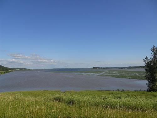
Photo shot north of town along 111 Highway where it meets Highway 159 heading to Rulo, Nebraska. Water is almost to bluff here. Highway 159 to Big Lake, Fortescue, MO, and Rulo, NE, is shut down under 8 feet of water in places.
There is no fifth destination.
-
FangKC
- City Hall
- Posts: 18205
- Joined: Sat Jul 26, 2003 10:02 pm
- Location: Old Northeast -- Indian Mound
Re: Flooding on the Missouri
Water in reservoirs on upper Missouri declines a little bit.
http://www.kansascity.com/2011/07/09/30 ... voirs.html
http://www.kansascity.com/2011/07/09/30 ... voirs.html
There is no fifth destination.
-
FangKC
- City Hall
- Posts: 18205
- Joined: Sat Jul 26, 2003 10:02 pm
- Location: Old Northeast -- Indian Mound
Re: Flooding on the Missouri
While concerns about flooding on the Missouri have mostly disappeared, the East Bottoms has had persistent problems all summer with stormwater backing up due to pump failure.
http://www.kansascity.com/2011/10/02/31 ... pt-in.html
http://www.kansascity.com/2011/10/02/31 ... pt-in.html
-
aknowledgeableperson
- City Center Square
- Posts: 12644
- Joined: Thu Mar 11, 2004 10:31 pm
Re: Flooding on the Missouri
Part of an article in the paper about the damage:KC0KEK wrote:What exactly is the damage that keeps it out of production for that long? The debris brought in by the floodwaters? Something else?
Near Bean Lake in Platte County is a stretch of land known as Harpst Island, where farmer Bob Baker’s family has worked the land for about 100 years.
The gravel road that snakes through the farm cuts past rows of sprouting corn stalks and tiny soybean plants just pushing out of the soil. But this year the scenery changes abruptly closer to the riverbank.
It could be mistaken for the Sahara Desert. The land is covered in fine, almost-white sand, and on the horizon a couple of bulldozers are shoveling it away.
One year after the flood of 2011, recovery is far from finished for local farmers whose land was devastated by the Missouri River.
Many still work to clear their land of debris and sand and wait for levees that are meant to protect it to be fixed. These farmers are in it for the long haul, prepared for the years it will take to remedy damage and hoping the fields they’ve been able to salvage will yield a successful crop.
While the full impact of the flood is unknown, it is clear that some land has been damaged beyond use, said Jim Crawford, a University of Missouri Extension natural resource engineer in Atchison County, Mo.
“There are a significant number of acres that were destroyed,” Crawford said.
Baker was among the area farmers hit hardest by the flood, which occurred when heavy rain and snowfall to the north forced dam releases along the Missouri River, sending a slow-moving wall of water from Montana to Missouri.
The swelling Missouri River spared only about 150 of Baker’s roughly 900 acres of farmland from sand deposits — a few inches on some land, up to 6 feet on other parts.
It took Baker two weeks just to clear the gravel road on his farm so he could get to his entire farm. Now, a year later, about 350 acres still aren’t ready for planting.
“Sometimes you can work for 10 to 12 hours a day and not see that you’ve made any difference,” Baker said. “I’m 62 years old, and I’ve never seen this much damage in my lifetime.”
Baker estimates that fully clearing his land will be a two- or three-year project. He and his team began removing sand at the start of October and worked through the winter and spring.
“It’s just kind of tough some days,” Baker said. “You do what you’ve got to do to get to get the work done.”
According to a November report completed by Scott Brown of the MU Department of Agricultural and Applied Economics, about 207,200 acres of cropland were flooded in 24 Missouri counties in the summer 2011 disaster. About 50 percent of the damage occurred in Holt and Atchison counties.
Read more here: http://www.kansascity.com/2012/06/02/36 ... rylink=cpy
Re: Flooding on the Missouri
Ya your correct.
-
FangKC
- City Hall
- Posts: 18205
- Joined: Sat Jul 26, 2003 10:02 pm
- Location: Old Northeast -- Indian Mound
Re: Flooding on the Missouri
I'm reactivating this thread as heavy flooding exists in Nebraska and the Missouri River is rising rapidly to flood stage as far south as St. Joseph and Leavenworth, which was caused by that Bomb Cyclone weather pattern that crossed the Great Plains yesterday.
Flood Statement
National Weather Service Kansas City/Pleasant Hill MO
1014 PM CDT Thu Mar 14 2019
...The Flood Warning continues for the following rivers in Kansas...
Missouri...
Missouri River at Atchison affecting Atchison...Buchanan and Platte
Counties.
Missouri River at Leavenworth affecting Leavenworth and Platte
Counties.
Missouri River at Parkville affecting Leavenworth...Wyandotte and
Platte Counties.
...The Flood Warning continues for the following rivers in Kansas...
Missouri...
Missouri River at St Joseph affecting Doniphan...Andrew and
Buchanan Counties.
This river forecast incorporates planned increased releases from Gavins
Point Dam. In addition, recent precipitation and estimated snowmelt runoff
are also included.
PRECAUTIONARY/PREPAREDNESS ACTIONS...
Do not drive through flowing water. Nearly half of all flood
fatalities are vehicle related. As little as 6 inches of water may
cause you to lose control of your vehicle. Two feet of water will
carry most vehicles away.This product along with additional weather
and stream information is available at www.weather.gov/kc/.
...
1014 PM CDT Thu Mar 14 2019
The Flood Warning continues for
The Missouri River at Leavenworth.
* until Tuesday March 26.
* At 9:00 PM Thursday the stage was 22.0 feet.
* Flood stage is 20.0 feet.
* Minor flooding is occurring and Moderate flooding is forecast.
* Forecast...The river will continue rising to near 29.2 feet by
Wednesday March 20th. The river will remain above flood stage
through at least March 24th.
* At 25.1 feet...Water overtops the levee north of Fort Leavenworth.
* At 23.4 feet...The Hildebrandt Island north of Fort Leavenworth
begins to flood and families in this area need to evacuate.
* At 22.3 feet...Water enters Riverfront Park in Leavenworth. In
addition, 2nd Street at the waste water treatment plant is closed
due to high water. Persons should vacate the park to avoid the loss
of life and property.
* At 20.0 feet...Lowland flooding occurs along the east and west
banks of the river.
Latest
Location FS Stage Day/Time Forecast
Missouri River
Leavenworth 20 22.0 Thu 09 PM 29.2 Wednesday March 20th
------------------------------------------------------------------------------------
Hazardous Weather Outlook
National Weather Service Kansas City/Pleasant Hill MO
502 AM CDT Fri Mar 15 2019
...
Atchison KS-Miami-Linn KS-Doniphan-Leavenworth-Wyandotte-Johnson KS-
Atchison MO-Nodaway-Worth-Gentry-Harrison-Mercer-Putnam-Schuyler-
Holt-Andrew-De Kalb-Daviess-Grundy-Sullivan-Adair-Buchanan-Clinton-
Caldwell-Livingston-Linn MO-Macon-Platte-Clay-Ray-Carroll-Chariton-
Randolph-Jackson-Lafayette-Saline-Howard-Cass-Johnson MO-Pettis-
Cooper-Bates-Henry-
502 AM CDT Fri Mar 15 2019
This hazardous weather outlook is for northwest...north central and
west central Missouri...as well as extreme eastern Kansas.
.DAY ONE...Today and Tonight
River flooding is ongoing on several area rivers, particularly the
Missouri River.
.DAYS TWO THROUGH SEVEN...Saturday through Thursday
Flooding on the Missouri River is expected to last into at least next
week. Major river flooding is expected on the Missouri in
northwestern Missouri and extreme northeastern Kansas.
More detailed information can be accessed at...
https://www.weather.gov/eax/hwo
https://www.weather.gov/wwamap/wwatxtge ... ct&wwa=all
-------------------------------------------------------------------------------------------------
-
FangKC
- City Hall
- Posts: 18205
- Joined: Sat Jul 26, 2003 10:02 pm
- Location: Old Northeast -- Indian Mound
Re: Flooding on the Missouri
The risk potential for major flooding this spring has been raised due to several factors. This estimate is put out by the National Weather Service, Omaha Office. The Missouri from Plattsmouth to Rulo is above average risk for major flooding this spring. Additional releases from the Gavins Point Dam will begin March 22nd.
Snowpack is much above normal risk. Soil moisture is above normal risk. Frost depth is above normal risk. Stream flow/stream levels are above normal risk. Precipitation risk is above normal risk. Ice jams are above normal risk.
https://www.weather.gov/media/oax/NWS_O ... 019_v2.pdf
Ice dams and ice jams are causing a lot of problems upstream. The other thing that will play heavily into the potential for flooding downstream at Kansas City will be any future and unpredictable rain deluges upstream like happened in 2011--most of which threatened over-topping dams on the Missouri, and causing them to fail.
Last edited by FangKC on Fri Mar 15, 2019 7:12 am, edited 2 times in total.
-
FangKC
- City Hall
- Posts: 18205
- Joined: Sat Jul 26, 2003 10:02 pm
- Location: Old Northeast -- Indian Mound
Re: Flooding on the Missouri
St. Joseph preparing for flooding as Missouri River nears third highest mark ever
https://www.kmbc.com/article/st-joseph- ... r/26830371
'I've never seen anything close to this': Rancher describes harrowing evacuation near collapsed Spencer Dam
Current flooding in Nebraska, Iowa rivals most devastating years as multiple rivers flood
Officials watching for surge into Missouri River from Platte River flooding
http://sandhillsexpress.com/local-news/ ... -flooding/
https://www.kmbc.com/article/st-joseph- ... r/26830371
'I've never seen anything close to this': Rancher describes harrowing evacuation near collapsed Spencer Dam
https://www.omaha.com/news/nebraska/i-v ... e4718.htmlLINCOLN — The phone rang at Paul Allen's ranch house along the Niobrara River at 6 a.m. It wasn't good news.
Five miles upstream, the Spencer Dam — a 91-year-old concrete structure — had "been compromised," and a wall of water was heading his way.
Just below the dam, a popular tavern, built of straw bales, was washed away, as was a bait shop, a half-dozen campers and a home. One man who lived in the home was missing.
"It looks like there was never anything there," said Allen, 75.
A quarter-mile section of U.S. 281 was washed out just south of the bridge over the Niobrara River. At the Allen ranch, floodwaters 4 to 5 feet deep inundated pastures and livestock pens, he said, tipping over stock trailers, flowing into farm sheds and tractors, and scattering cattle.
...
Current flooding in Nebraska, Iowa rivals most devastating years as multiple rivers flood
https://www.omaha.com/news/nebraska/cur ... contextual...
Overnight, the Missouri River at Plattsmouth hit a record high of 37.15 feet, surpassing the previous high of 36.73 feet in 2011. The Platte River at near Leshara reached 12.23 feet, beating the last historical crest of 11.84 feet.
...
Officials watching for surge into Missouri River from Platte River flooding
http://sandhillsexpress.com/local-news/ ... -flooding/
-
FangKC
- City Hall
- Posts: 18205
- Joined: Sat Jul 26, 2003 10:02 pm
- Location: Old Northeast -- Indian Mound
Re: Flooding on the Missouri
Interstate 29 north of Rock Port closed because of flooding
Missouri River flooding closing roads in northwest Missouri, northeast Kansas
Missouri River flooding closing roads in northwest Missouri, northeast Kansas
https://www.kmbc.com/article/interstat ... g/26838941According to the Army Corps of Engineers, Interstate 29 North has been closed from Rockport, Missouri, to the Iowa state line because of flooding from the Missouri River.
I-29 is also closed in Iowa in both directions from Pacific Junction, Iowa, to the Missouri state line. The interstate is the major highway that connects Kansas City to Omaha and additional cities to the north.
...
Re: Flooding on the Missouri
I was through there yesterday. It was ligit worry some. Wasn't sure I was going to make it out of Iowa.
-
FangKC
- City Hall
- Posts: 18205
- Joined: Sat Jul 26, 2003 10:02 pm
- Location: Old Northeast -- Indian Mound
Re: Flooding on the Missouri
Gavins Point Releases Reach 90k
https://www.nwd.usace.army.mil/Media/Ne ... reach-90k/Water releases from Gavins Point Dam will be increased to 90,000 cubic feet per second at 8 pm today as unregulated inflows from the Niobrara and other watersheds continue to spill into the reservoir, the U.S. Army Corps of Engineers reported today.
Operators at Gavins Point are using 12 of the 14 spillway bays and the powerhouse to pass the flows. The remaining two spillway gates are partially open, but frozen in place due to ice buildup. Operators are spilling water over those two gate in an effort to thaw them and return them to operating condition, which dam safety engineers believe presents no risk to the structure or the gates nor does it affect the Corps’ ability to safely pass water pass the structure.
The water being released from Gavins Point is exclusively from unregulated tributaries that bring water into the reservoir. On Wednesday, the Corps stopped all releases from Fort Randall Dam, the next dam upstream on the Missouri River mainstem, to reduce the amount of water in the lower Missouri River. However, because there is very little storage capacity behind Gavins Point, most of what is flowing into the reservoir must be released downstream. Despite these efforts, communities from Sioux City, Iowa to St. Louis continue to experience flooding, or the threat of flooding, due to runoff from the numerous rivers and creek through the lower section of the river.
Emergency managers and engineers from the Corps’ Omaha and Kansas City districts are supporting state and local authorities with levee monitoring and other flood response activities, to include technical advice and sand bag distribution.
Additionally, the Corps is working the National Weather Service to monitor conditions. The National Weather Service has issued flood warnings along the Missouri River and its tributaries from southeastern South Dakota to St. Louis. More information on those warnings is available at https://www.weather.gov/mbrfc/
...
-
FangKC
- City Hall
- Posts: 18205
- Joined: Sat Jul 26, 2003 10:02 pm
- Location: Old Northeast -- Indian Mound
Re: Flooding on the Missouri
Near Fremont, NE, cattle are becoming trapped on small islands of land surrounded by floodwaters.
https://twitter.com/NEStatePatrol/statu ... 6493492226
https://twitter.com/NEStatePatrol/statu ... 6493492226
-
FangKC
- City Hall
- Posts: 18205
- Joined: Sat Jul 26, 2003 10:02 pm
- Location: Old Northeast -- Indian Mound
Re: Flooding on the Missouri
Flooding exceeds historic record in Plattsmouth, NE. Worse than 2011.
Record flooding hits Plattsmouth, warning issued
Record flooding hits Plattsmouth, warning issued
https://fremonttribune.com/community/ca ... user-share...
Indeed, flooding in the Plattsmouth area along the banks of the Missouri River has reached record levels, according to the weather service.
A record height of 37.15 feet, more than 11 feet above flood stage, was recorded at 7:15 p.m. Thursday, according to weather service. The local flood stage is 26 feet. The previous record was 36.73 feet on June 30, 2011.
“Record flooding is occurring and record flooding is forecast,” the weather service said. “The river will remain around 37.2 feet today (Friday).”
At 35 feet, wells for the city of Plattsmouth begin to be impacted by floodwaters, according to the weather service.
...
-
FangKC
- City Hall
- Posts: 18205
- Joined: Sat Jul 26, 2003 10:02 pm
- Location: Old Northeast -- Indian Mound
Re: Flooding on the Missouri
First responders, local residents helping each other during floods
https://fremonttribune.com/community/ca ... user-share...
Brueggemann has served as Cass County Sheriff since 1991 and has taken part in many emergency operations during that time. Two of the worst situations came when historic flooding moved through the area both in 1993 and 2011.
Many other members of city departments and local police, fire and rescue crews also took part in flooding missions in those years. They have used that expertise to try to assist people in the best possible way in 2019.
The Flood of 2019 has already set several historic marks. The Platte River at Louisville soared to an all-time high level of 13.74 feet at 6:15 p.m. Saturday. It is the first time in recorded history that the Platte has gone above 13 feet at Louisville. The previous record of 12.45 feet came on March 30, 1960.
The Missouri River at Plattsmouth reached an all-time high mark of 40.62 feet at 5:30 p.m. Saturday. It is the first time in recorded history that the Missouri has gone above 37 feet at Plattsmouth. The previous record of 36.73 feet came on June 30, 2011.
National Weather Service forecasters are expecting both rivers to continue rising through Sunday evening. Authorities closed both Highway 75 bridges over the Platte River on Friday. Water began spilling over the bridges late Friday night. All traffic is now being detoured on Highway 66 to Louisville and across the two lanes of the Highway 50 bridge.
...
-
FangKC
- City Hall
- Posts: 18205
- Joined: Sat Jul 26, 2003 10:02 pm
- Location: Old Northeast -- Indian Mound
Re: Flooding on the Missouri
FLOOD UPDATES: Mandatory evacuation in Fremont areas near Platte
https://www.wowt.com/content/news/FLOOD ... 85191.html...
Interstate 29 is closed from the Highways 275/92 junction to Rock Port, Mo.
...
Offutt Air Force Base is preparing for flooding as the Base Lake and FAM Camp areas are under an evacuation order, according to a press release from Offutt's public affair's office. Base personnel are "taking necessary precautions to minimize damage in anticipation of flooding."
The 55th Civil Engineer Squadron is working closely with the Army Corps of Engineers, the state of Nebraska and the city of Bellevue to discuss potential flooding issues, the release states.
"More than 20,000 sandbags have been ordered and will be filled by base personnel to distribute throughout the base for the protection of facilities and resource," the release states.
...
All lanes of Interstate 29 are now closed from Pacific Junction, near Plattsmouth, to the Missouri state line, according to Iowa 511.
...Southbound Interstate 29 is closed between Highway 34 and Highway 275, near Pacific Junction, and the Missouri State Line, near Hamburg. A detour is in operation, according to Iowa 511.
...
-
FangKC
- City Hall
- Posts: 18205
- Joined: Sat Jul 26, 2003 10:02 pm
- Location: Old Northeast -- Indian Mound
Re: Flooding on the Missouri
Offutt Air Force Base falls victim to flooding
https://www.wowt.com/content/news/Offut ... 75691.html
https://www.wowt.com/content/news/Offut ... 75691.html
-
FangKC
- City Hall
- Posts: 18205
- Joined: Sat Jul 26, 2003 10:02 pm
- Location: Old Northeast -- Indian Mound
Re: Flooding on the Missouri
Photo showing Spencer Dam after collapse. Wait for the pop-up.
https://www.facebook.com/NWSOmaha/photo ... =3&theater
https://www.facebook.com/NWSOmaha/photo ... =3&theater
-
FangKC
- City Hall
- Posts: 18205
- Joined: Sat Jul 26, 2003 10:02 pm
- Location: Old Northeast -- Indian Mound
Re: Flooding on the Missouri
Missouri River spills into Hamburg, Iowa, other cities; more rain could be on the way
https://www.omaha.com/weather/missouri- ... 35236.html...
The Army Corps of Engineers on Sunday warned that some 210 miles of levees along the Missouri River between Offutt Air Force Base and Leavenworth, Kansas, have been compromised. That stretch touches Nebraska, Iowa, Kansas and Missouri.
“The majority of the levee system along the Missouri River south of Omaha continues to deteriorate,” said Col. John Hudson, commander of the Omaha district of the Corps of Engineers. “The bulk of the levees are overtopped or breached.”
...
Rain in the forecast
The National Weather Service said rain is moving into the area Monday night into Tuesday.
...
-
FangKC
- City Hall
- Posts: 18205
- Joined: Sat Jul 26, 2003 10:02 pm
- Location: Old Northeast -- Indian Mound
Re: Flooding on the Missouri
One-third of Offutt underwater; at least 30 buildings damaged in flood
https://www.omaha.com/news/military/air ... aaf32.html...
Even the U.S. Air Force couldn’t stop the Mighty Missouri River from flooding Offutt Air Force Base.
Between Saturday night and early Sunday, the 55th Wing called off a 30-hour, round-the-clock sandbagging effort because the floodwaters were rising too fast.
“It was a lost cause. We gave up,” said Tech. Sgt. Rachelle Blake, a 55th Wing spokeswoman.
By Sunday morning, one-third of the base was underwater, she said. Thirty buildings, including the 55th Wing headquarters and the two major aircraft maintenance facilities, had been flooded with up to 8 feet of water, and 30 more structures damaged. About 3,000 feet of the base’s 11,700-foot runway was submerged. No one, though, had been injured.
...
-
FangKC
- City Hall
- Posts: 18205
- Joined: Sat Jul 26, 2003 10:02 pm
- Location: Old Northeast -- Indian Mound
Re: Flooding on the Missouri
More evacuations in Midwest as floodwaters head downstream
https://www.kansascity.com/news/busines ... 55949.html...
The Nebraska Emergency Management Agency highlighted some remarkably high crests. The Missouri River was expected to reach 41 feet (12.5 meters) in Plattsmouth on Sunday — 4 feet (1.22 meters) above the record set in 2011. The Elkhorn River got to 24.6 feet (7.5 meters) Saturday in Waterloo, breaking the 1962 record by 5 1/2 feet (1.68 meters).
In hard-hit Sarpy County, Nebraska, up to 500 homes have been damaged, including some cabins along a lake, said Greg London of the Sarpy County Sheriff's Office. The damage followed breaches of levees along the Platte River on Thursday and Saturday, and a Missouri River levee break on Thursday. The two rivers converge there.
London said many of the damaged homes are wet up to the roof line and likely ruined.
"This area's had flooding before but not of this magnitude," London said. "This is unprecedented."
...